Sunday, May 20, 2012

RIO CHAMA TRAIL

After one day rest of having an inflammation shot to reduce the swelling on my rib cage I was once again rearing to head out on a trail.  And was told that I could, so up bright and early and ready to hit the trail, backpack filled with snack, lunch and plenty of water, we took to the Rio Chama Trail.
The day was beautiful with sun out bright and temps just perfect.  The Trail head starts at either Heron Lake or at El Vado Lake.  It runs through the Chama wildlife management area and it’s 5.5 miles-one way.  However, due to the fact that the trail does go through the wildlife management-we could only walk a ways before we had to turn around.  The wildlife management is closed until Memorial weekend, when it all opens up to hikers.
So being that we are camped at Heron Lake, we started at that end.  When first driving towards the trail head, you see what we would call a graveyard for junk.  It belongs to the state park and it’s where they either store or keep their extra docks; whether in good shape or not.  Also is a huge pile of large boulders that they use as blockage to areas they don’t want folks near.
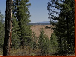
But once parked, is a very nice area with a few picnic table and a couple of benches overlooking the trail head and the canyon.  Plenty of shade with large Ponderosas around.
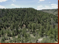
DSC07158'
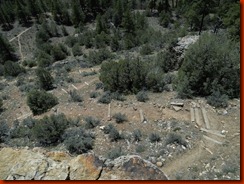
When first starting out at this end (Heron Lake), you will descend down a wooden staircase before you start with switchbacks until you get down to the river and the swinging bridge.
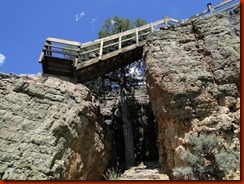
DSC06991DSC07157
If hiking in springtime, be warn-you may get buzzed by hummingbirds; Specially if you wear red hat! 
As you approach the river you come to an extension bridge, or as some call a swinging bridge that goes across the Rio Chama.  This was built by the Youth Conservation back in the 80’s.  since then the State Park has tried to maintain this trail through federal grants.  The staircase and the bridge is solid, but the switchback shows signs of washout and abuse.  The repairs are done the best way it could be done.  However, this trail is not for those with bad knees, hips or are frail.
Many only go as far as the bridge, and then turn around, instead of taking the hike further on, as we did.  The bridge is really amazing as how it’s being supported.
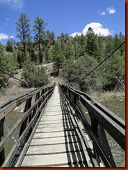
DSC07003            DSC07155
DSC07150        DSC07000
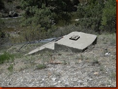
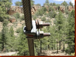
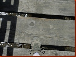
In the above pictures, the first one shows the cables that support this bridge.  The second picture shows one of four cements that supports the cables. Third picture shows the size of u-bolts that are used.  And the fourth picture shows how far apart the boards maybe in crossing.  Word of caution:  if small children are with you-you might want to watch them closely-so not to get their foot caught!
And yes, you can make the bridge swing-we did! 
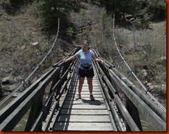
DSC07005I was hanging on while Brian was both trying to take my picture and swing the bridge.
Now that you are done playing on the bridge, it’s time to take the hike.  At first we thought that we would climb back straight up the ridgeline-but instead we veered to the right and went along the edge-keeping the Rio Chama in eyesight the whole time.  Then we curved and slowly started the climb upwards.  We just went slow and steady and enjoyed the view. 
You are socked in with Ponderosa, Juniper and other types of trees.  Being it was morning, it was cool during this part of the hike, and breathtaking.
What seemed like we should have gone at least  3/4th of mile or better, we only went about 1/4th of a mile.  This was due  to the climb upwards and going slow.  We came across a picnic table out in the middle of nowhere, with somewhat a view through the tree lines of the Heron Dam.
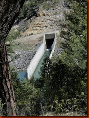
DSC07120    DSC07122
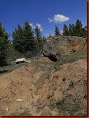
As we continue on the hike, we came across an interesting spot where a large boulder had sometime recently broken off, coming down the mountain side and crossing over the trail before landing in it’s new permanent spot.      To one’s eye that didn’t know better, they would have assumed that this happened in the last few years.  But upon reading and researching it was learned that it happened back in 2005.  Here is a picture of the slide, and where the rock landed: 
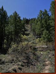
DSC07123      DSC07124
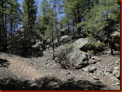
There were points of the trail that was overgrown and narrow and at times we even wonder if we were actually on the trail.  The only marker you have is after each mile, if you look closely you may come across a mile marker.  The terrain was uneven crossing from rocks, to solid mud to needle pack or leave pack ground; and you really never knew what was or might be around the bend.  We always kept our eyes wide open and our ears tune to our surrounding at all times.
We finally came to a place where there was a marker that explained the area and that the overview from there was now overlooking El Vado Lake.  This was a good resting area for refueling our bodies with nutrition.
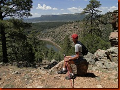
DSC07136 
Farther down the trail we came across a spectacular view of both El Vado Lake and Heron Lake.
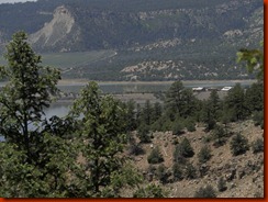
DSC07143 El Vado Lake with the pennisula…You can’t see it well in this picture, but the middle house apparently was recently destroyed by a fire.  Can you image the view these people have?
We kept on this hike, we knew that we could not do the whole hike this day and would only travel half of it.  Every time we thought we might turn around, our curiosity would get the best of us and we would say “let’s go to the next bend”.  We still had plenty of water and we know that when half gone, we would have no choice BUT to turn around-for our own safety.
Anyways once again we said we would go to the crevasse in the rocks-but again we decided to climb through this crevasse and reach the top mesa before turning around.  It was very narrow and due to the weather warming, we had to go cautiously for unwelcome critters (snakes).  I only got half way up when I was greeted with 100’s of flies.  I told Brian to turn around and head back down.  Not sure what had caused all those flies, but we didn’t want to stick around and see either.  It was time to head back. (We soon later learned that at this mesa-the trail closes and becomes part of the wildlife management).
Heading back, a little slower, we came across some scat.  It belonged to a bear.  What discover that it apparently crosses here frequently because there was “old” scat with fresh on top.  As we were “examining” this scat, we heard noises below us and then a cub bear crying for momma;  It defiantly was time to get out of there! 
Whew-that was a little too close.  We both had our mace ready, whistles/horns in hand and we kept looking back over our shoulder just to make sure we were not being followed.
All-in-all we had a great hike and loved every minute of it.  We calculated on our GPS (E-Trex) that we hiked just about 5 miles round trip and took us 4 hours.  We had to take lots of camera breaks and of course water and food break.
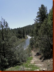
DSC07114    DSC07130
Some day we may return when the whole trail system is open and due the whole thing-round trip. 
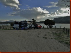
Tuesday, May 15, 2012

ALTITUDE ADJUSTMENT

We have been traveling and visiting New Mexico’s state parks now for over a month.  We started out at Navajo Dam near Farmington.  Elevation there was only at 6100 above sea level.
Now to some that isn’t really much-while to others anything over 4000 feet is too high.  Last year while working at James M. Robb/CO River State Park near Grand Junction, we had a older lady that came from the mid west area that got elevation sickness and we were barely over the 4000 feet.  She ended up having to cut her family visit and go back down to sea level.  I really felt sorry for her and her family-for that meant going almost back home.  I remember saying to Brian that I sure hope that never happens to us while we start our adventure.


Now 12+ years ago when we started to live in an RV and I went to my doctor for my “last” check-up with him; I remember him telling me due to the fact that I do have bad lungs (Severe Chronic Asthma)-I would have to take altitude climbing very serious and gave me strict instructions to go by;  and they were:  anything over 4000 feet, I must only go about 500 feet a day, come back down at night, got back up during daytime for about 2-3 days.  At any point if I felt heaviness in my chest-descend immediately and don’t go back up!  He didn’t think I could ever really go high in elevation and stay any length of time.


Have I taken his advise?  Well, no not actually.  And I haven’t done bad-until now….Since starting our travels, each year my asthma has improved greatly.  Recently I had donated my nebulizer machine to a clinic and no longer carry any kind of inhaler.  But I almost wish now that I at least have an inhaler. 


I had no trouble ascending from 4000 feet to 6000 feet.  Even at 7000 feet, I still wasn’t showing much sign of distress in my lungs or chest.  Oh I occasionally would have a little shortness of breath after extreme hiking and would have to take short breaks to catch my breath, but Brian too was having the same effect-so nothing too worry about.  Just take it easy and go slow.


Now that we have ascended to over 7500 feet, breathing started to get a little more stressful.  We have been here for over a week and only hiked a couple of days with rest in between.  Shortness of breath was coming more frequent-but for the both of us.  I notice since being here, that I’m a little more short temper and agitated and didn’t’ know why.  Surely by now we should be well adjusted to the elevation.  wrong!


Generally, yes, a week adjustment  is sufficient for some to acclimate their bodies to elevation.  BUT it actually takes 3 months for a body to develop more red blood cells to get your oxygen level back to normal.  During this time your body retains more water fluids that actually can go to your heart, lung and brain.


That still wasn’t the total case for me when we made a quick dash to the urgent care in Tierra Amarilla in NM.  I started out having difficulty a few nights ago waking up with what I thought was a racing heart.  I ignored it until it happened again the other night.  But upon getting up yesterday I still had chest pain (felt as though Brian was sitting on my chest and wouldn’t get off), and very short of breath.  As I moved around, I felt better.  Going into Chama to run errands, felt fine.  But after coming back and doing some work, the shortness of breath came back along with the chest pain and the racing heart.  I knew it wasn’t a heart attack, but also knew something just wasn’t right.


Upon entering the clinic I was taken back immediately. an EKG was taken and my theory was right-I wasn’t having a heart attack.  But it wasn’t my lungs either-for they had no wheezing and sounded clear.  Which also meant there wasn’t fluid building either.  So what was causing me to be in distress? 
The last several days we have been socked in with rain and humidity which was enough to cause an onset of severe inflammation on all of my cartilage in my chest and rib bones.  The inflammation was putting added stress on my heart-making it feel as though it was racing.


The doctor was hilarious!  As she is pressing on my chest bone, asking me if that hurt-Brian makes the comment back that oh no we got a quack!  She turns around and actually smacked him! 
But in all seriousness, I had to have an anti-inflammatory shot to reduce the swelling so that I can get back to enjoying life!  I actually had a wonderful team and got excellent care in such a small tiny community.
But at first the doctor talked about us having to descend back down.  I was devastated, for we already had paid for the Cumbre & Toltec Train ride and I wasn’t ready to leave the area yet!  I now don’t have to leave!


But here is a few tips for those that are planning on traveling to higher country and they are not acclimated to the elevation:
  • Don’t go from 0 to 100 !  What I mean by that, is let’s say you are at sea level and you plan on camping at 10,000 feet above sea level.  Do it in increments.  Start at 4000 feet for a night, then climb a few thousand and stay for another night or two.  Providing you are not having any difficulties or your body isn’t in stress.  
  • Once in high elevation: don’t over exert yourself-even if you feel fine.  Wait a day or two.  Even setting up camp can be stressful to your heart and lungs and you don’t know it. 
  • Don’t drink alcohol the first night or two-again give your body time to adjust.  alcohol goes to the blood stream  faster  in higher elevation.
  • Take water pills and an anti-inflammatory pill (ibuprofen) to help reduce extra fluid build up in your body.  But please consult your physician first; specially if you have any medical conditions.
Here are some signs that your body maybe in stress from high elevation:
  • Headaches.  This is normal to most that ascend.  But if gets extreme-then it’s probably a warning sign that you may need to descend.
  • Loss of Appetite:  This could be the beginning and warning sign that something isn’t right, don’t ignore it!
  • Agitation or Grumpiness:  Remember, less oxygen the higher you go, which means less oxygen for the brain-can make one more grumpier than normal.
  • Shortness of Breath:  this is very common when ascending and can be expected.  However, if gets extreme even when sitting down-then it’s time to think about descending!  Seek professional help!
  • NAUSEA:  If you get to the point that you feel sick, you need to seek professional help and descend immediately!
  • Dizziness Or Light Headed:  Once again-you need to descend ASAP!  This means fluid is starting to build and you need to go back down and seek medical attention.
Once fluid has started to build around your lungs, heart or in the brain,this becomes a serious medical condition and needs proper medical attention.  Thinking that descending is going to help, it will, but you will need professional help as well.  Folks die every year because they ignore the warning signs.  And don’t think age matters-it don’t….


Unfortunately because my lungs are damaged due to past asthma attacks, I will not be able to spend any time over 9000 feet and above.  I can go for the day and be okay, but not overnight.  So elevation I must always know how high I’m at.


Remember: this is just an advise, and before any elevation climbing, check first with your own physician before going on such an adventure and don’t ignore your own body’s warning signs.  Only you know what your body can or cannot handle.

Monday, May 7, 2012

EL VADO LAKE, NM

El Vado Lake is tucked away and does not get a lot of spring time visitors. Partially because it is so far out to the lake. Coming from HWY 84/64 turn onto Hwy 112, you go about 10 miles then turn right onto the Park entrance road and travel another 4 miles before entering the park.


When we pulled into this lush green park-there was only one other camper. 
We found a perfect spot with a fantastic view of the lake.  It actually was a shared site-however one half was being redone and no one was or would be working on it-so we had the whole area to ourselves.
DSC06810
Upon entering the park, we needed to fill our tank with water.  As Brian was busy doing this I was checking out other sites-just to make sure the one we picked was perfect. As I’m checking it out-here comes a 5th wheel in.
Now being older and not in shape-I make a fast dash to the car, and go park the car on our future site.  Whew-just in the nick of time, because that 5th wheel had the same exact spot in mind.
That site become ours for the next few weeks.  At one point we were the only campers in the park.  Occasionally we would see maybe one or two other campers coming in but only for a night or two.
Springtime at El Vado lake is very slow.  The lake isn’t big, however it’s the only lake near Chama that anyone can take a boat and run it wide open.  Therefore we have been told that come summertime the lake is very, very busy with all types of boats, pontoons, jet skis-you name it-if it’s got speed it will be on the lake.  While there-we were lucky to only see one or two boats on the lake.
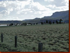
Again we were fortunate because by summertime-the grassy fields will burn up and turn more brown than the lush green that we had the pleasure of enjoying.
DSC06782
Half of the campground was closed and only the main area (Elk Run) was open for business.  Elk Run has two full hook-up sites that are generally used for volunteers.  Otherwise sites had water and electric or were totally primitive.  Pinion Beach and Shale Point have no electric or water on sites.
Compare this park to Navajo it’s by far a smaller park run by only two rangers and was by far in much better condition.  Once entering the park you go from paved road to gravel roadways.  The main area (Elk Run) is more solid pack than Pinion Beach or Shale Point.  All sites in Elk Run gave you plenty of space for large rigs to get in and move around and you were not on top of one another.  Several sites were share sites-each having their own electric and water. 
No large trees to hit on, all were trimmed back to give the big rigs plenty of room.  Shale Point is not large rig friendly and there really is only a few sites down that way.  A smaller unit could get in there if they choose too. 
Being this park is more in the High Desert of the mountain area-there wasn’t really any big trees to speak of.  Lots of Juniper and Pinions.
Pinion Beach is large rig friendly, however, the road is not gravel pack as the main area was.  If no heavy rains are predicted, you could get in and out with out any mishaps.  Some sites were very secluded and close to the lake.  We wish this was open when we were there-maybe another time.
The shower building does not open until about a week or two just before Memorial Weekend.  There is a pit toilet near the boat ramp and one or two in the two areas that were closed.
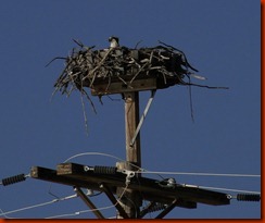
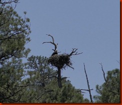
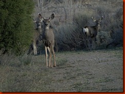
As for wildlife viewing; many osprey's were nesting in the closed area.  And from afar we discovered a pair of eagles that were also nesting.  We came across some mule deer and enjoyed watching them romp around the rabbit brush.DSC06783   DSC06925
DSC06788
One of the reason’s of wanting to stop and spend time here was the trail that links El Vado Lake to Heron  Lake-The Rio Chama Trail.  According to research it would be a perfect place for hiking and viewing wildlife.
We didn’t realize that part of the trail crosses over to the Wild Life Management Area and therefore was closed on the El Vado end.  We were told by the lake manager the reason the trail was closed was so that hikers don’t disturb the wildlife as they are with their young ones. It would open again on Memorial Weekend.  Now in the same breath he then claims that Turkey hunting was allowed in this exact area that are closed to hikers!  Now-that made absolutely no sense what-so-ever!  It’s not okay to hike-where we are quiet and there only to view, not to hunt.  Hunters are there to hunt….What is wrong with that picture???
We took a quick tour over to Heron-and the Trail is open at that end…..no-it makes no sense at all to us…wonder if I need to contact someone about that situation and what kind of response I would get????
All-in-all we did enjoy our quiet time there at El Vado Lake.  But it was also starting to get boring since the trail was closed and so it was time to move on a little sooner than planned.  That’s why we love not being on any kind of schedule.
We decided to only go a very short distant-Heron Lake.  Here, there are three intertwining trails-including the Rio Chama Trail-that is open from this end.  More to look at, to see and to hike!

Friday, May 4, 2012

LAKESHORE DRIVE?

On most of the lakes and even some coastal areas of the Gulf, we have come across the most popular name for streets: Lakeshore Drive.

Lakeshore Drive usually means folks with lots of money that will have fancy homes and some being gated.  The streets are probably in better shape than the main streets in the town. 

Whenever we come across Lakeshore Drives we are always amazed by those that live in that area and then say to ourselves “not in our lifetime will we ever own such a home”.

Now I can honestly say we have come across a Lakeshore Drive that we actually could afford to live on-if we ever choose too to settle down….

This Lakeshore Drive is situated right along the western side of El Vado Lake in NM.  And I’m pretty sure that property value will never be extremely expensive here nor will taxes be high.  Not much money is spent on road improvements.

DSC06835 

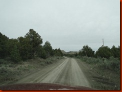
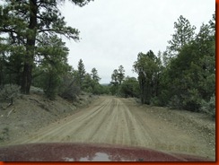
It’s almost a given that if you plan to live on this Lakeshore Drive, you will need a 4X4 vehicle and high clearance would be wise.  Only due to the fact that it was dry when we took our little tracker on this little tour that we didn’t need to put it in 4X4 ourselves.  But if it had been wet or even snow-we would not have gotten through.  some of the ruts I had to dodge and there were one or two hairpins that we prayed another vehicle was not flying around the corner.  We ran into one jeep at the beginning of this little adventure.

Lakeshore drive is 16 miles along the lake with homes and even campers tucked in where one would never imagine they could get in-but they do.  Some areas of the road is one lane only!

DSC06842

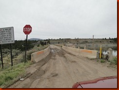
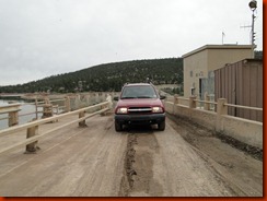
In order to access this road, there is a width limit across the El Vado Dam and is only 10-feet.  There is a warning sign that if you touch the barriers on either side-you must back up! 

DSC06829         DSC06834We have never come across a dam like this before.  Our teeth were jarred by the time we crossed over and our nerves rattled!

If you really like seclusion and privacy-then this would defiantly be the place to go.  There is however one minor problem to owning property in this section of Lakeshore Drive.  You can have septic tanks put in-but there is no water table for drilling your own well.  You have to haul water in from other areas.  The fish hatchery in Los Ojos every Tuesday allows those folks to come down and get free water.   A few will “sneak” into the park and fill water that way.

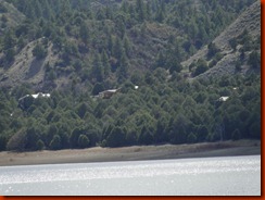
DSC06916Homes that are tucked in along Lakeshore Drive.

Now on the North end of El Vado Lake is a much more developed community that does have the fancier homes with sewer and water on the property and yes, private fences, however the road isn’t paved, but hard pack gravel and easy to get around anytime of the year.

After talking with the park ranger of El Vado Lake it amazes him on how many big RV’s will try to take this road to a few of their primitive campsites on the west side of the lake. When they finally get to where ever  they maybe trying to go, their RV’s usually have damage done one way or the other. It’s NOT a road for RV’s-unless it’s high clearance and made for that kind of roughness.

Lakeshore Drive does eventually end and become Hwy 95 to Herron Lake; which is adjacent to El Vado Lake.